We have decided to stay in the Haverstraw NY area as there are a couple of hurricanes working their way up the East Coast and as they tend not to be perfectly predictable. Based on the current forecast, being 30 miles or so inland ought to be enough to knock this down to a good storm and not much else. Safe enough for the time being.
The main challenge is that to get to the Chesapeake you have to leave NY Harbour and head out into the Atlantic where you run for about 215KM along the coast @ our cruising speed of 15KM/H = 14.5hours of run time. No problem for the boat, but it would make for a long day with most of the driving being done by me.
So the combination of storms and good seamanship guidelines will call this phase of our our journey to an end. We will return in a month or so when the storms pass and we can muster a small crew to make the turn through the Atlantic and back into protected inland waters where we can more easily continue our journey south in the Chesapeake and likely to the Carolinas.
All in all we learned a great deal about ourselves, the boat and the lifestyle. We can share our respective thoughts on that front in another post.
Cheers!
Friday, September 3, 2010
The Hudson
Over the last few days we have been working our way down the Hudson River (SOUTH!) In fact I just figured out how to calculate distance on a track and since we have been using just one track from Penatang to here I can report with complete accuracy that we have covered 1211KM to date. Not bad given the detours and delays.
We left off at the Troy Lock, the last one on the Erie Canal system just outside of Waterford and headed for Catskill. To help along the way there area series of light houses all built to a common standard but each a little unique none the less.


If light houses are not quite your idea of excitement you can always take a quick cat nap in the late morning sun before it warms up too much later in the day.

Once you get up again you will note that since the Hudson runs North / South through some very busy industrial and residential areas you will see lots of bridges - big tall bridges of all kinds. My personal favourites are the 19th century stone and iron truss style with the support provided from girding below. That said, the modern suspension bridges are elegant and require fewer pilings and support. How ever you like your bridges - you will find them here.
Between the bridges you might have to dodge a tug or two as they shuttle materials from one plant to another. Quite impressive rigs - and they throw less of a wake than Reviresco does.

The industrial nature of the Hudson can't be overlooked. There are a great number of gravel pits along the shores that supply the barges and no doubt construction in NY NY - they have to get their building materials from somewhere and the river makes a convenient location.
That said, there were more interesting and picturesque views to be enjoyed as well.
We left off at the Troy Lock, the last one on the Erie Canal system just outside of Waterford and headed for Catskill. To help along the way there area series of light houses all built to a common standard but each a little unique none the less.


If light houses are not quite your idea of excitement you can always take a quick cat nap in the late morning sun before it warms up too much later in the day.

Once you get up again you will note that since the Hudson runs North / South through some very busy industrial and residential areas you will see lots of bridges - big tall bridges of all kinds. My personal favourites are the 19th century stone and iron truss style with the support provided from girding below. That said, the modern suspension bridges are elegant and require fewer pilings and support. How ever you like your bridges - you will find them here.
 |
| Gotta love all that steel and rivets! |
 |
| Modern large span suspension bridge |
 |
| Modern Pilings Old Steel Rail lines above |
Between the bridges you might have to dodge a tug or two as they shuttle materials from one plant to another. Quite impressive rigs - and they throw less of a wake than Reviresco does.

The industrial nature of the Hudson can't be overlooked. There are a great number of gravel pits along the shores that supply the barges and no doubt construction in NY NY - they have to get their building materials from somewhere and the river makes a convenient location.
 |
| To put the scale in perspective - there is a huge bulldozer working at the top of one of those piles of gravel on the right side of the picture - I saw it after we passed the factory. |
 |
| Nuclear Plan (I think) The water temp went up to 81F from 69F up river! |
That said, there were more interesting and picturesque views to be enjoyed as well.
 |
| The Old West Point Campus building |
 |
| The New West Point Campus building and marina |
 |
| Bannerman Castle on the Hudson |
Catskill did not seem like much of a place on the map, and it was a very small town, but the people there were really quite nice and we met up with Captain Steve Martin (not as funny - but very good natured and a wealth of information) who was curious about our boat and stopped over to help us dock. He helped orient us to the task of getting to the Chesapeake from personal experience as a delivery captain.
Once we left Catskill we went on to Haverstraw - where we are now bringing our first leg of the journey to an end. It's a nice marina with a pool and other more impressive neighbouring boats to keep you humble.
 |
| Sculpture as you enter Havistraw Marina |
 |
| As we get closer to NY NY - everything starts getting bigger! |
We have made arrangements to store Reviresco on the hard for a month or so and then to move her further south again when the weather gets better. We will continue the blog from time to time as we make progress.
More to come!!
Cheers!!
Wednesday, September 1, 2010
The "Eerie" Canal
That's what Sue calls it anyway - because in the mornings with the mist on the water and no one around it seems quite eerie!
However, when the sun comes up it turned into some beautiful sunny Hot days! The Erie Canal is more picturesque and with 23 locks to complete offers many little breaks along the way.
 Waterford was quite nice with 5 locks back to back. We had to wait an hour for 15 people in Kayaks to go through - they could have carried their boats thank you very much! It was a nice little town.
We could have taken hundreds of pictures of people fishing along the way - you would swear it's a national past time. On every river bank and wall there were people drowning worms. However, these two took the prize for walking a few miles back in the bush, following the canal to a dam - then standing on the edge where the water flows over and fly fishing off the top!
I have mentioned that we have been slowing it down quite a few notches in past blogs. However, to put this in perspective, there are biking trails along the side of the canal in spots. It was in just one of these areas that an old man rode PAST US in the same direction. He left us in the dust!
I should also note that the US is a heavy user of trains - you can hear them along the canal every 15 minutes or so - dozens and dozens day and night! I had a little fun one afternoon when one was getting up to speed right beside the canal. I thought I could catch the attention of the conductor with 3 long pulls on the my rather large air horns - he happily returned 3 in kind. It was like a US vs. CAN hockey game and we both scored!
Next on to the Hudson and then South - for real this time!!!
 |
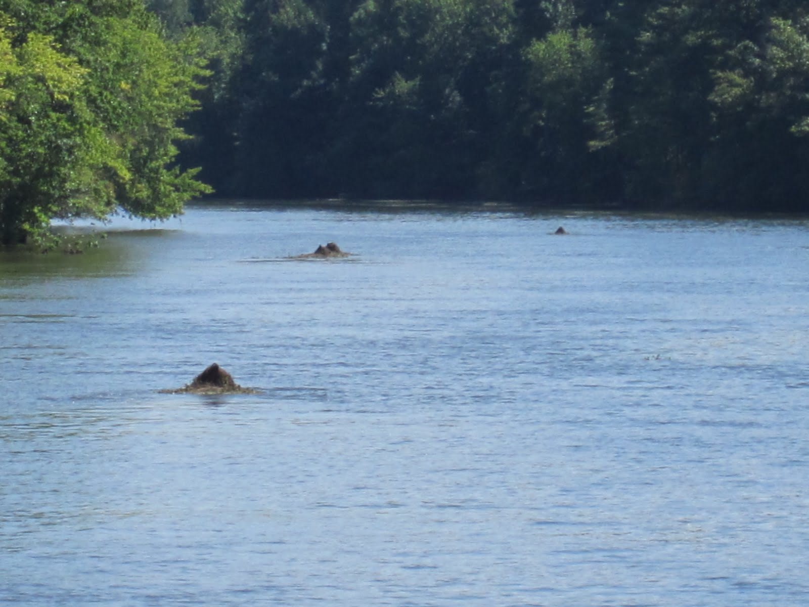
| We think this is some kind of Eerie Canal Monster |
 |
| Probably lives under this bridge |
However, when the sun comes up it turned into some beautiful sunny Hot days! The Erie Canal is more picturesque and with 23 locks to complete offers many little breaks along the way.
 |
| Little Tug |
 |
| Big Tug in NY State colours |
 |
| Lots of old infrastructure |
 |
| Pick a side any side! |
 |
| Flood Control Gates |
 |
| Just in case you were not sure where to go... |
 |
| Love these old factories - classic! |
 |
| Neat bridge with lots of current. |

 |
| Waterford Flight Lock 6-2 33Ft each! |
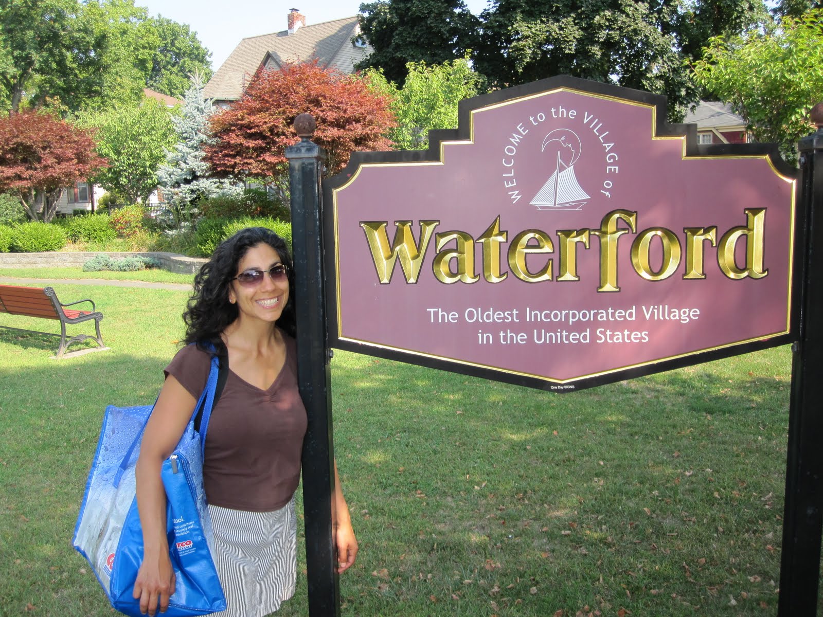 |
| Waterford was incorporated in 1792! |
 |
| Tied up in Waterford |
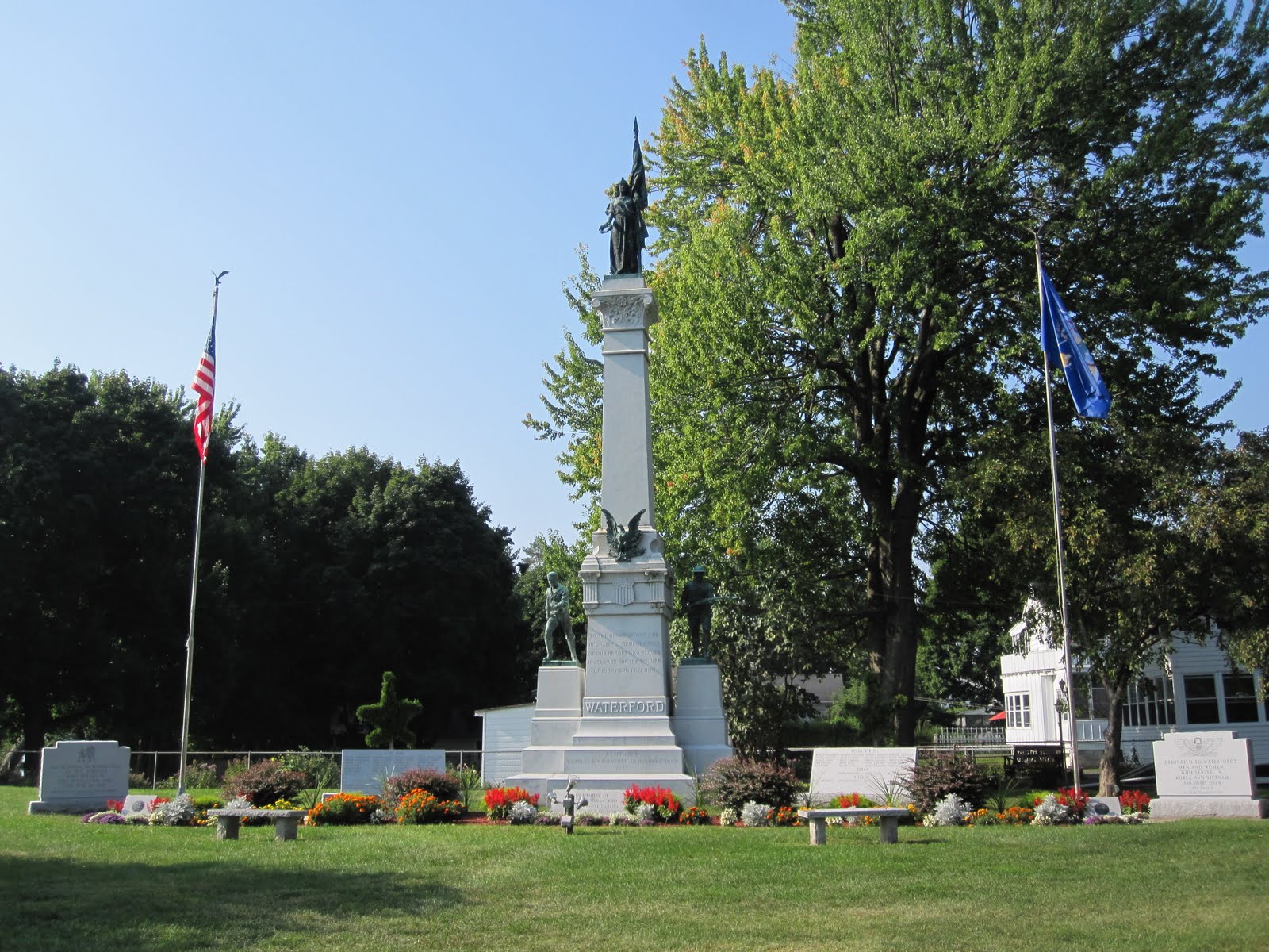 |
| Waterford War Memorial including the Civil War - Desert Storm. |
We could have taken hundreds of pictures of people fishing along the way - you would swear it's a national past time. On every river bank and wall there were people drowning worms. However, these two took the prize for walking a few miles back in the bush, following the canal to a dam - then standing on the edge where the water flows over and fly fishing off the top!
 |
| Watch that one step back - it's a 5 foot drop! |
I have mentioned that we have been slowing it down quite a few notches in past blogs. However, to put this in perspective, there are biking trails along the side of the canal in spots. It was in just one of these areas that an old man rode PAST US in the same direction. He left us in the dust!
 |
| A speed demon by comparison! |
I should also note that the US is a heavy user of trains - you can hear them along the canal every 15 minutes or so - dozens and dozens day and night! I had a little fun one afternoon when one was getting up to speed right beside the canal. I thought I could catch the attention of the conductor with 3 long pulls on the my rather large air horns - he happily returned 3 in kind. It was like a US vs. CAN hockey game and we both scored!
 |
| A typical Erie lock |
 |
| Last Lock to go South on the Hudson - the Troy-US Lock |
Next on to the Hudson and then South - for real this time!!!
Oswego Canal Is Open!
After a week closed the Oswego Canal system was finally opened for traffic On Saturday August 27th! So we lost 2 days to "miscellaneous activities", and 3 days to Canal closures. Once again our goal was to go with the flow, and we are! That said - we have to make up for some lost time or we will barely clear the Canadian border!
So we set off on Saturday at noon and put in a full day with a goal to clear all 7 locks on the Oswego and get lined up or the Erie Canal. All in all it was a smooth ride, very little traffic.
The main difference between Canadian and NY Locks is in the people. In Canada we have 2-4 folks staffing the locks, helping with the lines, keeping you company, offering you advice on the next lock, handing out collector cards of wildlife and nearby attractions. In NY there is only one person, a rope to hang on to and a request for your pass #. that said, the pass was only 20% the cost it was in Canada and the over night moorage is free and sometimes comes with power - in Canada that will be another $50 a night thank you very much! So all in all let's call it a push.
When we first hear that the Oswego Canal was closed we thought it could not be closed for long. So the water was a little high - they can drain it with the many dams along the way. However, the water swell that they went through moved the water line up nearly 4 feet! It wiped out shorelines, swept away thousands of old dead trees and logs, moved channel markers, threw sea weed up on everything and generally made the passage quite impossible. Even after 5 days closed for repairs, there were a great many buoys and signs out of place or missing. We were dodging logs and flotsam at all times.
That said, no damage and no real problems to report - so we continued on to the Erie Canal!
Now we can head South (well still more East actually!)
So we set off on Saturday at noon and put in a full day with a goal to clear all 7 locks on the Oswego and get lined up or the Erie Canal. All in all it was a smooth ride, very little traffic.
The main difference between Canadian and NY Locks is in the people. In Canada we have 2-4 folks staffing the locks, helping with the lines, keeping you company, offering you advice on the next lock, handing out collector cards of wildlife and nearby attractions. In NY there is only one person, a rope to hang on to and a request for your pass #. that said, the pass was only 20% the cost it was in Canada and the over night moorage is free and sometimes comes with power - in Canada that will be another $50 a night thank you very much! So all in all let's call it a push.
 |
| A little courtesy goes a long way! |
 |
| A typical Lock on the Canal - kind of like a water castle |
 |
| Those are channel markers covered in weeds |
 |
| A typical in town tie up. |
 |
| One of many stately homes on the waterway |
 |
| Sue just loves ducks! |
 |
| The Canal can be quite natural in spots. |
When we first hear that the Oswego Canal was closed we thought it could not be closed for long. So the water was a little high - they can drain it with the many dams along the way. However, the water swell that they went through moved the water line up nearly 4 feet! It wiped out shorelines, swept away thousands of old dead trees and logs, moved channel markers, threw sea weed up on everything and generally made the passage quite impossible. Even after 5 days closed for repairs, there were a great many buoys and signs out of place or missing. We were dodging logs and flotsam at all times.
That said, no damage and no real problems to report - so we continued on to the Erie Canal!
Now we can head South (well still more East actually!)
Crossing Lake Ontario
Before we set out we created a profile with the Canadian Coast Guard. This provided them data on our boat, equipment and safety gear. With our profile established we set up a Sail Plan for the crossing with check in points along the way to ensure we were on track and safe.
We Left Kingston at around 8:00AM with a nice sunny day and light winds. The Canadian Coast Guard reported wave conditions as less than 1 M - and they were right (to the border). The ride was quite smooth for about 2/3 of the run and then we picked up some 3-4 foot beam seas that made Sue a little queezie so she took a quick nap in our stateroom where the wave action was greatly reduced. All in all we checked in with the Coast Guard 3 times and provided updates on our location, heading and speed. We arrived safe and sound in Oswego at 3:00PM.
Next was passing US Customs and Immigration, Border Protection and getting all our paperwork in place. First, Passports and declarations. Second was a Customs Certificate for the boat for year 2010. Lastly, a cruising permit for inland waterways in the US. Sounds easy, but the online systems and faxing required to pull it all together took the rest of the afternoon and the morning the next day.
However, with the bureaucracy completed, were were set to head south (but mostly east) down the Oswego Canal!
Let's go!
We Left Kingston at around 8:00AM with a nice sunny day and light winds. The Canadian Coast Guard reported wave conditions as less than 1 M - and they were right (to the border). The ride was quite smooth for about 2/3 of the run and then we picked up some 3-4 foot beam seas that made Sue a little queezie so she took a quick nap in our stateroom where the wave action was greatly reduced. All in all we checked in with the Coast Guard 3 times and provided updates on our location, heading and speed. We arrived safe and sound in Oswego at 3:00PM.
 |
| Last light house on the Canada Side! |
 |
| Leaving Kingston behind us! |
 |
| No one but us and the tankers. |
 |
| Oswego is mostly industrial. |
 |
| Very Industrial! |
 |
| Oswego Harbour on Left and the full crossing track to Right. |
Next was passing US Customs and Immigration, Border Protection and getting all our paperwork in place. First, Passports and declarations. Second was a Customs Certificate for the boat for year 2010. Lastly, a cruising permit for inland waterways in the US. Sounds easy, but the online systems and faxing required to pull it all together took the rest of the afternoon and the morning the next day.
However, with the bureaucracy completed, were were set to head south (but mostly east) down the Oswego Canal!
Let's go!
Subscribe to:
Posts (Atom)